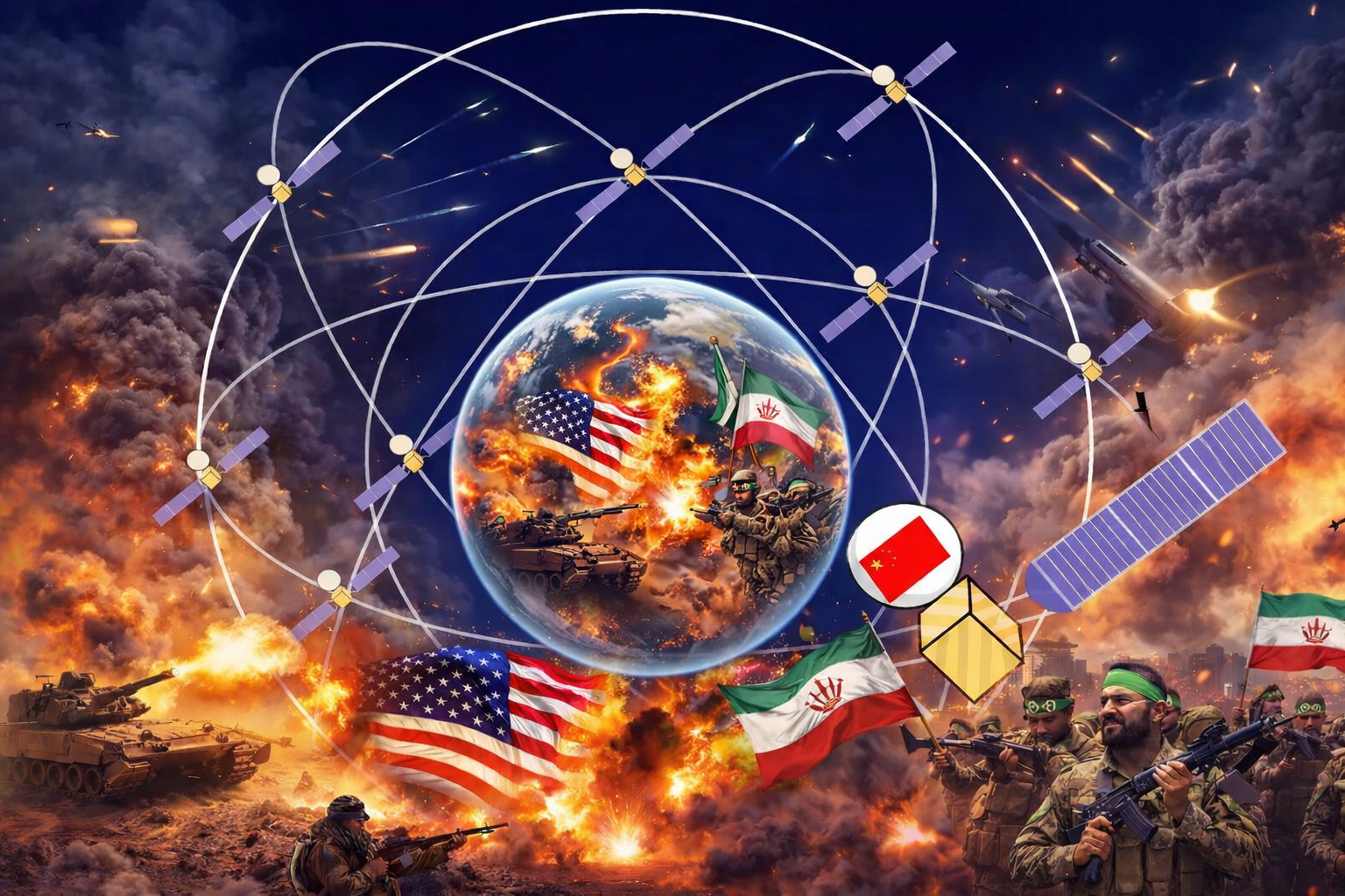
中国衛星「北斗」と宇宙インフラ戦争
米中宇宙測位衛星の能力比較――イラン戦争における運用事例を通じて―
BeiDou Satellites and the War for Space Infrastructure
A Comparative Analysis of U.S. and Chinese Positioning Satellites — Through the Lens of Operational Cases in the Iran War
Issue No. 003
2026年3月12日
発行元:一般財団法人 日本危機管理研究所
*英訳版は日本語版の後に掲載しています。/ The English translation follows the Japanese text below.
■ エグゼクティブサマリー
・中国の衛星航法システム「北斗(BeiDou)」が、中東の軍事バランスに影響を与えている可能性が指摘されている。
・情報専門家によれば、イランが北斗を利用してイスラエルや中東の米軍資産を標的化している可能性がある。
・最近の戦争では、イランのミサイル精度が以前より向上したと分析されている。
・これは衛星測位・サイバー・宇宙インフラが融合した新しい戦争形態を示す可能性がある。
・現代の軍事力は兵器だけでなく、宇宙インフラ(衛星)とサイバー技術の支配に大きく依存している。
・GPS中心だった世界の測位秩序は、中国の北斗など複数システムによる競争時代に入りつつある。
■ 中国宇宙衛星「北斗」と宇宙インフラ戦争
1. 衛星測位が現代戦の基盤
現代の軍事作戦では、衛星航法システム(GNSS)が重要な役割を持つ。
主な用途は、
・ミサイル誘導
・ドローン制御
・精密爆撃
・部隊位置の把握
・海軍・空軍の作戦支援
つまり、衛星測位は現代戦の「神経系」とも言えるインフラである。
2. GPS支配から多極化へ
これまでこの分野で圧倒的優位を持っていたのは米国である。米国の GPS(全地球測位システム) は、
・航空
・海運
・通信
・金融
など世界のインフラを支えてきた。
また軍事面では、
・精密誘導兵器
・巡航ミサイル
・軍用ドローン
の基盤として使われてきた。さらに米国は特定地域でGPS信号を制御・妨害する能力を持つとされ、これが長年の軍事優位を支えてきた。
3. 中国宇宙衛星「北斗」の登場
この構図を変えつつあるのが中国の宇宙衛星「北斗(BeiDou)」である。北斗は2010年代に急速に整備、2020年に世界規模の測位サービスを完成。これにより中国は”GPSに依存しない独立した宇宙インフラ”を確立した。
北斗とGPSは民生利用ではいずれも数メートル級の測位精度を持つとされ、一般利用において決定的な差があるわけではない。重要なのは精度の優劣ではなく、”どの国家が測位インフラを支配しているか”という点である。
4. イランと「北斗」の可能性
最近の中東情勢では次の指摘がある。情報専門家によれば”イランが中国の「北斗」を利用している可能性”があるという。目的はイスラエルの軍事拠点、中東の米軍資産をより正確に標的化するためとみられる。 またフランス元対外情報長官 アラン・ジュイエ氏 は、最近の戦争で「イランのミサイル精度が大幅に向上した」と指摘している。特にイスラエルとの衝突以降に精度向上が顕著とされる。ただし、中国が北斗を提供した確定的証拠は存在しないため、現時点では分析段階の指摘にとどまる。
5. サイバー・宇宙融合戦争
この問題の本質は単なるミサイル性能ではない。現代戦では
・宇宙(衛星)
・サイバー
・AI
・通信ネットワーク
が一体化している。つまり”宇宙インフラを制する国が戦争を有利に進める”構造になっている。
6. 宇宙測位の「静かな冷戦」
現在、世界には複数の衛星測位システムが存在する。
・米国:GPS
・中国:北斗
・ロシア:GLONASS
・欧州:Galileo
これは宇宙インフラ覇権をめぐる競争とも言える。
7. 日本への意味
日本にとってもこの問題は重要である。中国のミサイル戦力は、
・北斗
・慣性誘導
・AI補正
などを組み合わせている可能性がある。
日本は「準天頂衛星システム(QZSS)」を整備し、GPSを補完する独自測位能力を強化している。宇宙インフラは今後の日本の安全保障政策にも大きく関わる。
■ 結論
現代の軍事バランスを決めるのは、兵器の数やミサイルの威力だけではない。それを支える
・宇宙インフラ
・サイバー能力
・通信ネットワーク
・データ解析
といった技術基盤の支配である。中国の宇宙衛星航法システム「北斗」の利用拡大は、宇宙・サイバー領域に広がる新たな地政学競争を象徴している。宇宙インフラをめぐる静かな競争は、すでに世界の戦略環境を変え始めている。
Notes(脚注):
Todd Harrison, Defense Against the Dark Arts in Space, CSIS.
U.S. Space Force, Global Positioning System Fact Sheet.
中国国家航天局(CNSA)「北斗衛星導航系統」公式資料。
Al Jazeera English, Middle East conflict analysis.
United Nations Office for Outer Space Affairs (UNOOSA), Global Navigation Satellite Systems Overview.
References(参考文献):
Al Jazeera English
https://aje.news/uhkcio
Al Jazeera English X投稿
https://x.com/ajenglish/status/2031778767073407418
Center for Strategic and International Studies (CSIS)
Todd Harrison, Defense Against the Dark Arts in Space
U.S. Space Force
Global Positioning System Fact Sheet
中国国家航天局(CNSA)
北斗衛星導航系統公式資料
United Nations Office for Outer Space Affairs (UNOOSA)
Global Navigation Satellite Systems Overview
・舩山 美保 理事・主任研究員
国際政治経済学・心理学を基盤にサイバーセキュリティインテリジェンスを専門とする。ISO/IEC JTC1 SC28副国際幹事を歴任し、国際規格の策定プロセスを主導した経験を持つ。現在はAIリスク・情報戦・危機管理政策を横断的に研究している。
BeiDou Satellites and the War for Space Infrastructure
A Comparative Analysis of U.S. and Chinese Positioning Satellites — Through the Lens of Operational Cases in the Iran War
Issue No. 003
Published: March 12, 2026
Publisher: Japan Institute for Crisis Management (一般財団法人 日本危機管理研究所)
Author: Miho Funayama
■ Executive Summary
- China’s satellite navigation system “BeiDou” has been identified as potentially influencing the military balance in the Middle East.
- According to intelligence experts, there is a possibility that Iran is using BeiDou to target Israeli and U.S. military assets in the Middle East.
- In recent conflicts, Iran’s missile accuracy has been assessed as improved compared to previously.
- This may indicate a new form of warfare in which satellite positioning, cyber, and space infrastructure have converged.
- Modern military power depends not only on weapons but heavily on the domination of space infrastructure (satellites) and cyber technology.
- The world’s positioning order, which had been centered on GPS, is entering an era of competition among multiple systems including China’s BeiDou.
1. Satellite Positioning as the Foundation of Modern Warfare
In modern military operations, Global Navigation Satellite Systems (GNSS) play a critical role.
Primary applications include:
- Missile guidance
- Drone control
- Precision bombing
- Tracking of troop positions
- Naval and air force operational support
In other words, satellite positioning is infrastructure that could be called the “nervous system” of modern warfare.
2. From GPS Dominance to Multipolarity
The United States has held overwhelming superiority in this domain until now. The U.S. GPS (Global Positioning System) has supported the world’s infrastructure across sectors including:
- Aviation
- Maritime shipping
- Communications
- Finance
In the military domain, it has served as the foundation for:
- Precision-guided munitions
- Cruise missiles
- Military drones
Furthermore, the United States is said to possess the capability to control and jam GPS signals in specific regions — a capability that has underpinned its long-standing military advantage.
3. The Emergence of China’s “BeiDou” Satellites
What is beginning to change this configuration is China’s space satellite system “BeiDou.” BeiDou was rapidly developed during the 2010s and completed global positioning services in 2020. Through this, China has established “an independent space infrastructure not dependent on GPS.”
BeiDou and GPS are said to offer positioning accuracy at the level of several meters in civilian applications, and there is no decisive difference between them for general use. What matters is not a comparison of accuracy, but “which nation controls the positioning infrastructure.”
4. Iran and the Possibility of “BeiDou”
In the current Middle East situation, the following has been noted. According to intelligence experts, “there is a possibility that Iran is utilizing China’s BeiDou.” The purpose is believed to be more precisely targeting Israeli military bases and U.S. military assets in the Middle East.
Furthermore, former French Director of Foreign Intelligence Alain Juillet has pointed out that “Iran’s missile accuracy has improved significantly” in recent conflicts. This improvement in accuracy has reportedly been particularly notable since the conflicts with Israel. However, since no definitive evidence exists that China provided BeiDou access, this remains at the stage of analytical assessment at the present time.
5. Cyber-Space Convergence Warfare
The essence of this problem is not simply missile performance. In modern warfare:
- Space (satellites)
- Cyber
- AI
- Communications networks
are integrated into a unified whole. In other words, the structure is one in which “the nation that controls space infrastructure gains advantage in warfare.”
6. The “Quiet Cold War” of Space Positioning
At present, multiple satellite positioning systems exist in the world:
- United States: GPS
- China: BeiDou
- Russia: GLONASS
- Europe: Galileo
This can also be described as a competition for hegemony over space infrastructure.
7. Implications for Japan
This issue is also important for Japan. China’s missile capabilities may be combining:
- BeiDou
- Inertial guidance
- AI-based correction
Japan has been developing its Quasi-Zenith Satellite System (QZSS / “Michibiki”), strengthening its own independent positioning capabilities that complement GPS. Space infrastructure has major implications for Japan’s future security policy.
■ Conclusion
What determines the modern military balance is not merely the number of weapons or the destructive power of missiles. It is the control of the technological foundations that support them — space infrastructure, cyber capabilities, communications networks, and data analysis.
The expanding utilization of China’s space satellite navigation system “BeiDou” symbolizes a new geopolitical competition extending across the space and cyber domains. The quiet competition over space infrastructure has already begun to transform the world’s strategic environment.
Notes
- Todd Harrison, Defense Against the Dark Arts in Space, CSIS.
- U.S. Space Force, Global Positioning System Fact Sheet.
- China National Space Administration (CNSA), “BeiDou Navigation Satellite System” official materials.
- Al Jazeera English, Middle East conflict analysis.
- United Nations Office for Outer Space Affairs (UNOOSA), Global Navigation Satellite Systems Overview.
References
- Al Jazeera English: https://aje.news/uhkcio
- Al Jazeera English X post: https://x.com/ajenglish/status/2031778767073407418
- Center for Strategic and International Studies (CSIS): Todd Harrison, Defense Against the Dark Arts in Space
- U.S. Space Force: Global Positioning System Fact Sheet
- China National Space Administration (CNSA): BeiDou Navigation Satellite System official materials
- United Nations Office for Outer Space Affairs (UNOOSA): Global Navigation Satellite Systems Overview
Author: Miho Funayama, Director and Senior Researcher Specializing in cyber security intelligence, grounded in international political economy and psychology. Has served as Vice International Secretary of ISO/IEC JTC1 SC28, leading international standards development processes. Currently engaged in cross-disciplinary research spanning AI risk, information warfare, and crisis management policy.
Miho Funayama — Director and Senior Research Fellow
Specializes in cybersecurity intelligence grounded in international political economy and psychology. Former Vice-International Secretary of ISO/IEC JTC1 SC28. Currently engaged in cross-disciplinary research on AI risk, information warfare, and crisis management policy.